


Beaufortain J2

Airelle
User
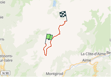

Length
12.9 km

Max alt
2443 m

Uphill gradient
665 m
Km-Effort
22 km

Min alt
2002 m

Downhill gradient
688 m
Boucle
No
Creation date :
2020-08-08 07:10:56.0
Updated on :
2020-08-14 15:01:33.081
6h48
Difficulty : Unknown

FREE GPS app for hiking
 SityTrail
IGN / Geographical institutes
SityTrail Plus
The world is yours!
About
Trail Walking of 12.9 km to be discovered at Auvergne-Rhône-Alpes, Savoy, La Léchère. This trail is proposed by Airelle.
Positioning
Country:
France
Region :
Auvergne-Rhône-Alpes
Department/Province :
Savoy
Municipality :
La Léchère
Location:
Naves
Start:(Dec)
Start:(UTM)
309611 ; 5050599 (32T) N.
Comments